Abstract
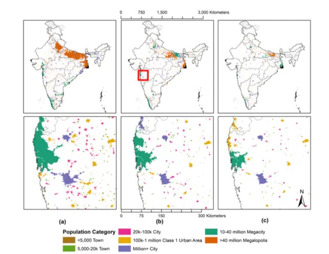
The measurement and characterization of urbanization crucially depends upon defining what counts as urban. According to The Indian Planning Commission, less than a third of the Indian population lives in urban areas, and while Indian cities are increasingly important to the economy, India is perceived fundamentally as a rural country. In this paper, we show that this received wisdom is an artefact of the definition of urbanity and the official statistics vastly undercount the level of urbanization and its importance for development policies in India.We begin by creating temporally-consistent, high-resolution population maps from sub district level population data available from the Indian Census for 2001 and 2011. The modeling framework is a two-step process that applies a Random Forest-based model to generate a prediction weighting layer subsequently used to inform a gridded dasymetric redistribution of original census counts at 100 m resolution (Stevens et al. 2015). We then apply density thresholds, contiguity conditions, distance based clustering and minimum population sizes to construct urban agglomerations for the entire country. Compared to the official estimates, we find that this approach counts 8%-30% (depending on thresholds) more urban population in 2011. We find large urban agglomerations that span large portions of Kerala and the Gangetic plain. Thus, while official estimates count more cities in the country, we delineate fewer cities but large urban regions that span jurisdictional boundaries. This has implication for urban policies.