Irregular settlements
 Urban Informality
About a third of the urban population in the world (~830 million) live in irregular/informal settlements/favelas/shanty towns/slums (United Nations Development Programme 2017). Whatever names these neighbourhoods take around the world, these settlements are at the core of many urban regions around the world; they provide affordable housing for urban poor but at high social and health costs. In urban areas, these types of settlements can constitute 30%-60% of the city and in some regions around the world, these settlements are the dominant urban form surpassing the formal settlements (Busgeeth et al. 2008; Kombe 2005). While denizens of these neighbourhoods may lack access to sanitation and other urban services or security of tenure, they tend develop bottom-up institutions (e.g. informal housing markets, vote banks) in myriad of ways that are interesting for students of urban politics and systems.
However, to study these phenomena, we need to know where these settlements are and how they change over time. Because official estimates grossly undercount or ignore people in these settlements, it is hard to study them. Very little is known about how the settlements change over time and how quickly they are changing in response to contested claims by different groups (Roy 2009).
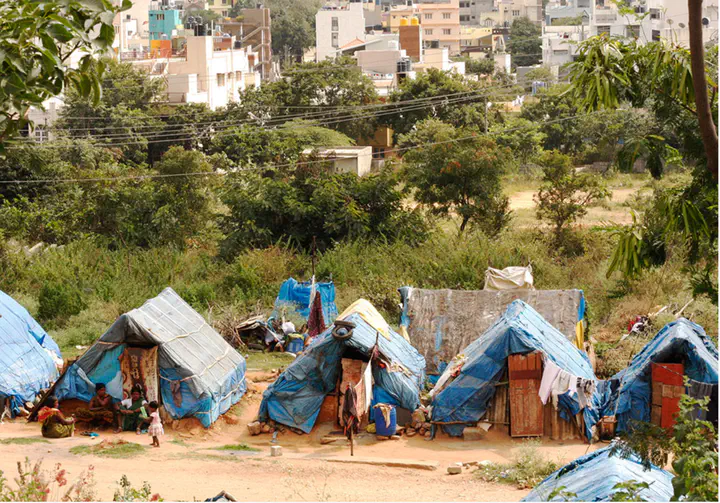
Around the world, these settlements have distinct morphological characteristics. They are often associated with poor housing quality, cramped houses, uneven building heights, lack of sanitation and drinking water infrastructure, uneven quality of construction, lack of vegetative cover, small setbacks and narrow roads. The diversity of these areas pose a challenges for coming up with consistent monitoring and for creating robust methods for detecting and characterizing settlements (Kit, Lüdeke, and Reckien 2012; Taubenböck and Kraff 2013; Weeks et al. 2007).
With the availability of high quality, high resolution, high frequency satellite imagery, it is becoming increasingly possible to develop methods that will reduce the on-ground monitoring and data collection costs. The goal of this project is to map and validate the irregular settlements in entirety of metropolitan areas in India. We are focusing on Bengaluru, Delhi, Jaipur, Hyderabad and Patna as the initial set of cities.
Collaborators
- [Dr. Raju Vastavai] (https://www.csc.ncsu.edu/people/rrvatsav)
- [Dr. Anirudh Krishna] (https://sanford.duke.edu/people/faculty/krishna-anirudh)
- Dr. Erik Wibbels
Nikhil Kaza
Professor
My research interests include urbanization patterns, local energy policy and equity